Staff Feature – Scarborough Waterfront Project
January 21, 2022
The Scarborough Bluffs are an iconic natural wonder. Towering above Toronto’s Lake Ontario waterfront, they offer a strikingly beautiful shoreline and natural greenspaces, and support increasingly rare habitats for a wide variety of fish, birds, and other wildlife.
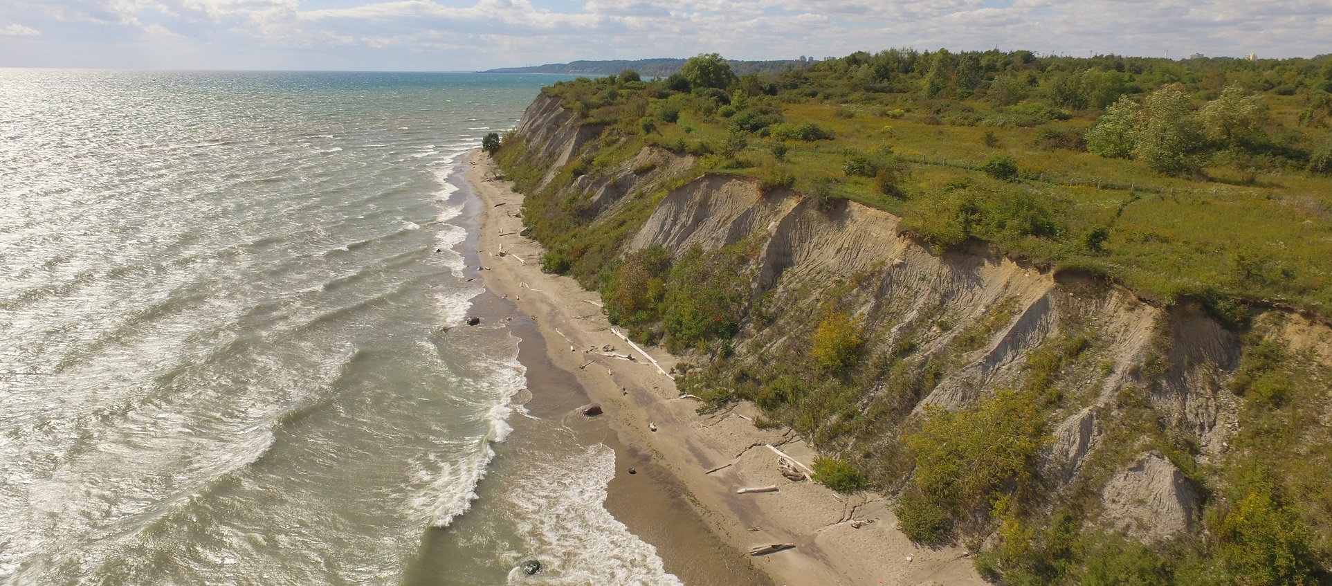
Being located among millions of people in the heart of the Greater Toronto Area means the management of this system is a balancing act. Building and maintaining infrastructure that offers shoreline protection and safe access to all, while protecting natural features and wildlife habitats, is key to ensuring that future generations will be able to enjoy the waterfront.
In partnership with the City of Toronto, TRCA undertook an Individual Environmental Assessment for the Scarborough Waterfront Project between 2014 and 2019. The purpose of the project is to provide safe public access and an enjoyable waterfront experience, while also protecting and enhancing the natural environment along an 11 kilometre stretch of shoreline between Bluffer’s Park and East Point Park in Toronto, Ontario.
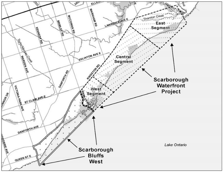
Scarborough Waterfront Project Study Area.
Those of you who have been involved in an Individual Environmental Assessment process know how comprehensive the work is. Various staff across the entire organization provided their expertise — it was truly a team effort. There was also a great deal of public interest in the project, which meant undertaking a robust consultation program.
Nancy Gaffney from the Government and Community Relations team and Katherine Learney from the Project Management Office were key to advancing the Environmental Assessment. Moving into detailed design, the project has been led by Katherine as part of the Professional Services team in the Restoration and Infrastructure division. Nicole Langton of the Project Management Office has also come on board.

Nancy Gaffney

Katherine Learney

Nicole Langton
With support from the City of Toronto, detailed design of the Western segment of the Scarborough Waterfront Project is well underway. This includes a multi-use trail along Brimley Road south from Kingston Road to Bluffers Park and shoreline enhancements from Bluffers Park to Meadowcliffe that will also accommodate a multi-use trail.
There are many challenges designing in an area with natural features constraints, dense infrastructure, and other technical considerations — but the team continues to persist and advance this critical work.
Physical modelling is being used for the shoreline to optimize design. This includes the construction of scaled models of the proposed headland, groyne, and berm features, which are then put to the test through wave simulations mimicking Lake Ontario storm events.
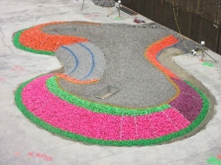
Scaled model of the expanded Bluffers Park Headland. Photo courtesy of NRC-OCRE.
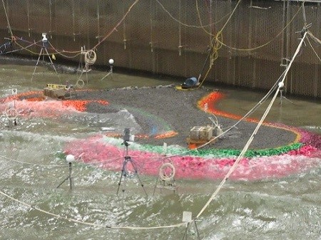
Headland model undergoing wave simulation testing. Photo courtesy of NRC-OCRE.
This work is being completed in partnership with Shoreplan Engineering Limited and the National Research Council of Canada’s Ocean, Coastal and River Engineering Research Centre in Ottawa.
In December 2021 Katherine and Nicole spearheaded a public information center for the Brimley Road Multi-Use Trail portion of the project.
They were the first to pilot a new virtual public meeting tool that the Restoration and Infrastructure division will be using for public consultation. You can explore this tool at getinvolved.ca/brimley. Similar information sharing will be done for the shoreline design in spring 2022.
Design is expected to be completed in 2022 with the Brimley Road Multi-use Trail prioritized for implementation to start by the end of the year.
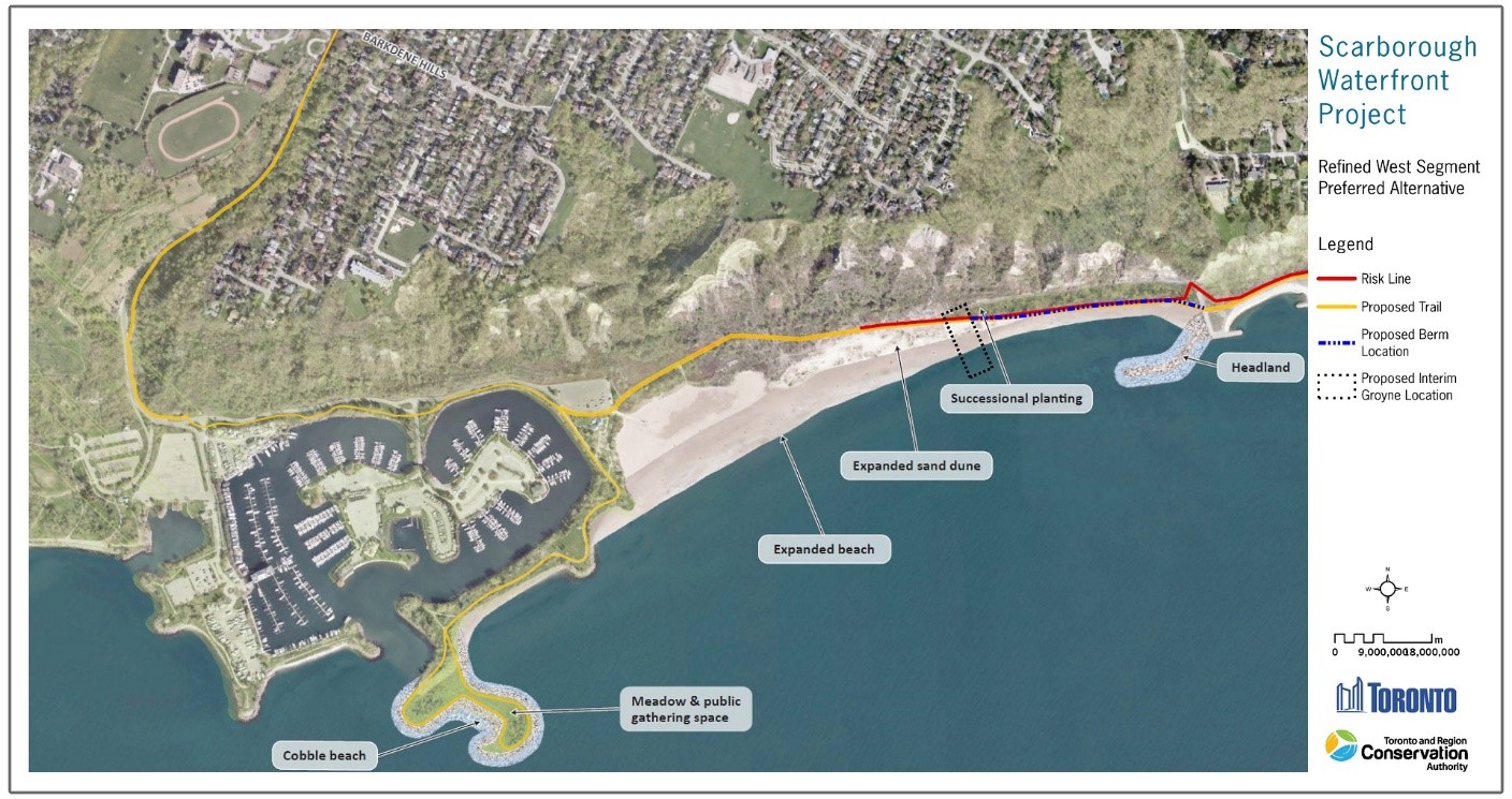
Conceptual design: Scarborough Waterfront Project – West Segment
In addition to the great work that continues to advance for the Scarborough Waterfront Project at the east end of the City, TRCA also received funding confirmation to undertake a new study for the shoreline from Bluffers Park west to R.C. Harris Water Treatment Plant. $2.9M was committed by the City of Toronto over three years to advance an Individual Environmental Assessment starting in 2022.
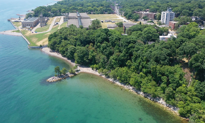
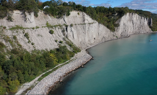
This section of the waterfront is characterized by the unique and provincially significant “Needles” bluff formation, located immediately west of Bluffers Park, and by steep slopes dividing the shoreline from inland areas, with limited public access to and along the water’s edge.
Looking west to R.C Harris Wastewater Treatment Plant.
Looking east to Bluffers Park.
Thank you to the Scarborough Waterfront Project team and all the staff who have contributed to advancing this important work. TRCA is committed to continued work with the City of Toronto and other key partners to ensure the Scarborough Waterfront is a place for safe and enjoyable waterfront experiences that are accessible to all.