Staff Feature – Erosion Hazard Monitoring and Erosion Studies & Analyses
September 17, 2021
Greater Than the Sum of Its Parts!
In 2008, a group of co-op students began their work term by inspecting all of TRCA’s erosion control structures across the jurisdiction, along with a watercourse inventory of Black Creek.
Thinking back to the team of veterans who then weathered the “emergency response” monitoring following the July 8, 2013 storm event, Andrew Jules smiles at the memories of future TRCA leaders sweating their way up and down the banks and channels of the watercourses of the impacted areas.
“Those were simpler times,” he says with a grin. “Matt [Johnston] (now Associate Director, Erosion Risk Management), Ashour [Rehana] (Manager, Capital and Special Projects, ERM), Rudra [Bissoon] (Project Manager, ERM), Darryl [Laramy] (Environmental Technologist, ERM), Sang [Lee] (currently Technical Assistant, ERM), and I would sometimes put in long shifts along with our group of field staff. That storm had a huge impact.”
As the young team followed up on public inquiries and triaged the requests for site inspections, the efficacy of their response triggered the growth of the team through the evolution of what it has become today.
Erosion Risk Management (ERM) consists of three primary sub-teams. This post focuses on the work of the Erosion Hazard Monitoring and Erosion Studies & Analyses teams. ERM’s Project Management team uses the information collected and prepared by these teams to plan and oversee the implementation of remedial erosion control projects.
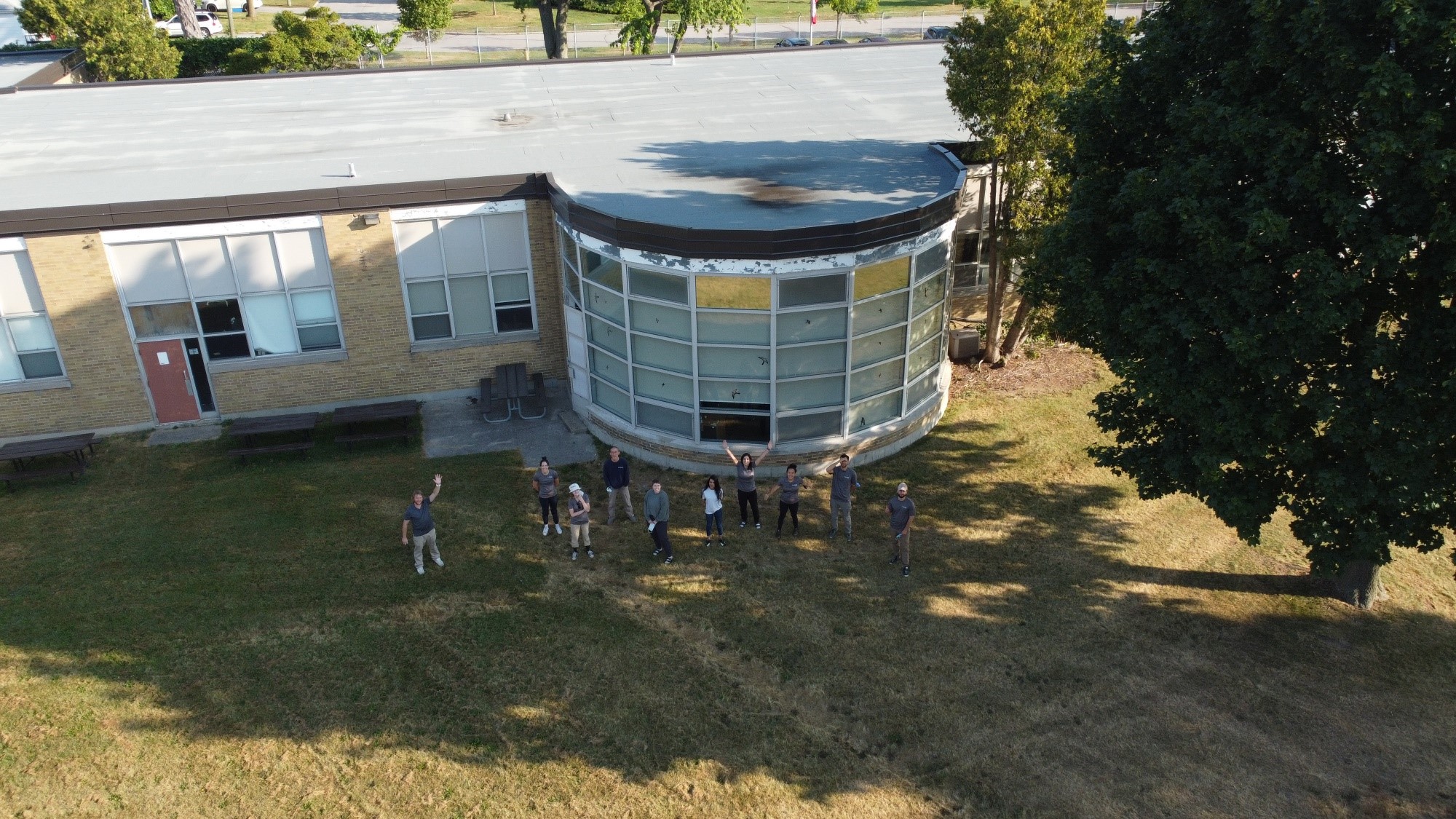
The 2021 crew at TRCA’s Eastville office. Left to right: Darryl Laramy, Sophia Clement, Kassidee Bambrough, Sang Lee, Shayla Snobelen, Thanya Aathavan, Amanda Partovi, Sarah Kim, John Hunkin, and Yusuf BenHalim.
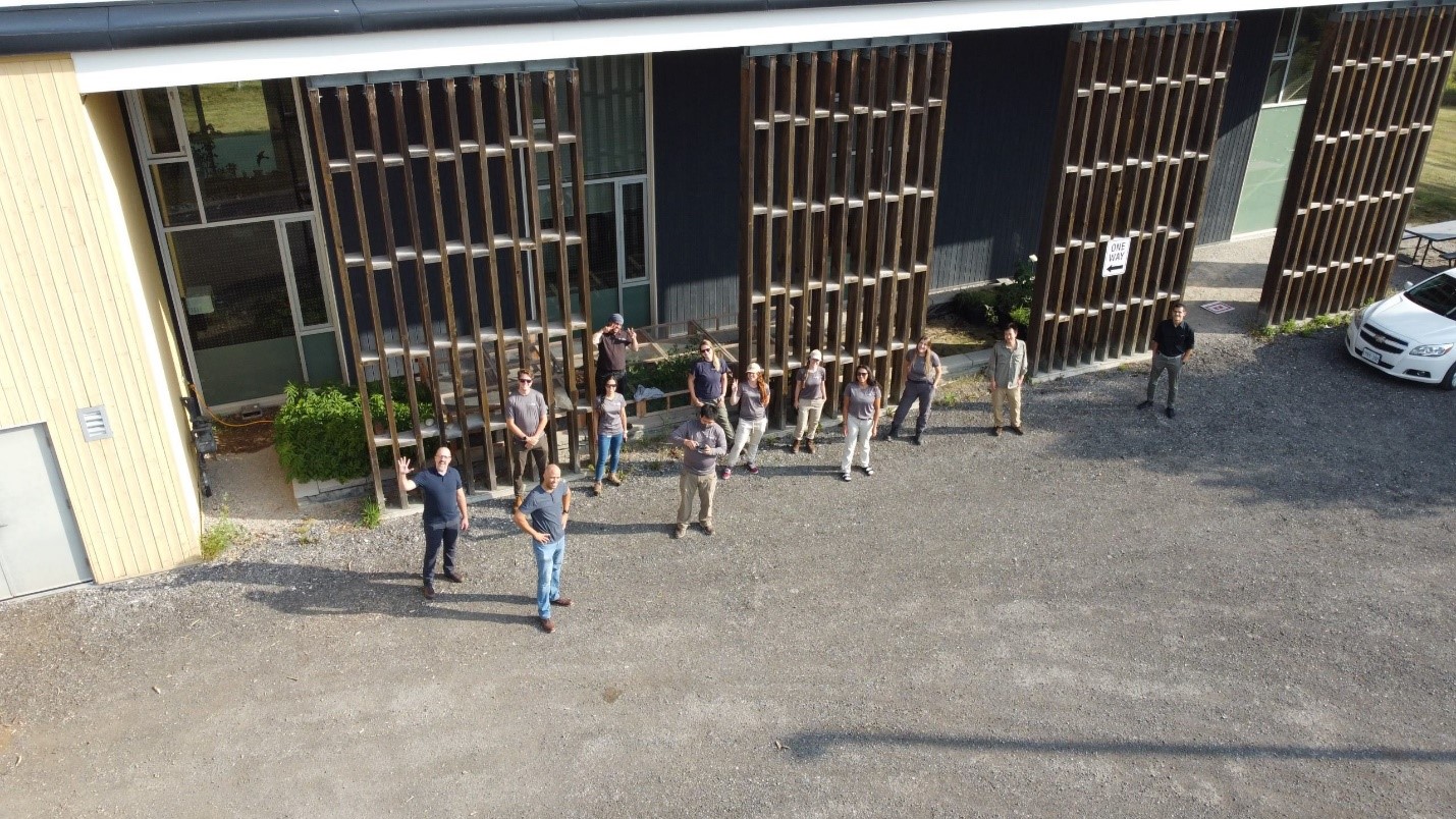
The 2021 crew at the Restoration Services Centre office. Left to right: David Gingerich, Aiden Mallany-Stanley, Andrew Jules, Olivia Tai, D.W. Mosher, Timothy Yoon, Emily Bowyer, Nicole Parr, Sara Casey, Rebecca Rodricks, Sabrina Hasselfelt, WonJai Jang, and Jamil Benhamida.
In June 2017, Andrew began supervising a large group of monitoring staff, along with a contingent of seasonal summer staff each year.
“The majority of our team supported the 2017 and 2019 high lake level events, as well as the 2018 ice storm,” he says. “I had confidence that we could roll with the punches.”
Andrew’s staff continue the tradition of excellence set by ERM’s leaders. “In 2017, 2018, and 2019 we averaged 4,595 site inspections. When the pandemic hit last year, we maintained a group of inspection staff and continued to safely inspect 4,850 sites across the jurisdiction.” This year’s team is on pace to complete at least 4,800 inspections by the end of 2021.
“We’re a resilient bunch,” says Andrew with a smile. “But I’d be happy with a ‘normal’ year in 2022.”
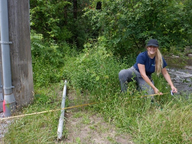
2021 team members Sabrina Hasselfelt (left) and Forest Xue (right) perform site inspections.
Supporting Andrew’s team, David Gingerich and Jamil Benhamida make up ERM’s Erosion Studies & Analyses team.
“We provide support to Andrew and his team, helping where we can with annual monitoring program summaries, geospatial analyses, and providing innovative analytical solutions to help the ERM group make use of the huge amounts of data that Andrew’s team are collecting every year: 4,800 sites times about 35 data points,” says Jamil, working through the mental math.
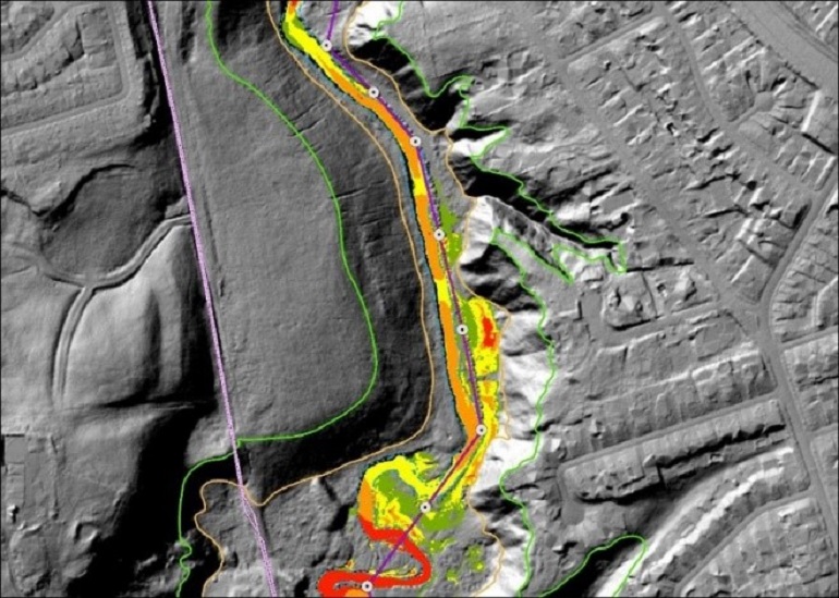
LiDAR Hillshade, ERM Screening Layers, York Region infrastructure, HEC-RAS-based raster.
“It’s exciting — and terrifying,” David says. “The state-of-the-art technology and methodology of assessing erosion risk on a watershed scale is evolving right now. We do our best to keep up. If we can help connect ERM’s data with other TRCA teams, then I hope we can look back one day and say that we made our colleagues’ jobs easier.”
ERM data collection has been integrating remotely piloted aircraft system (RPAS) data into its regularly scheduled inspections of Scarborough bluff recession sites and shoreline erosion control structure inspections.
Along with the services and products provided by the RPAS team, Andrew’s Erosion Hazard Monitoring team has two microdrones, operated by four certified staff pilots. These vehicles are typically used to collect aerial imagery and videos at valley erosion hazard sites, where slope stability and height issues can restrict the safe collection of data by ground crews.
The combination of erosion hazard monitoring experience and state-of-the-art technology has these teams excited about their future potential.
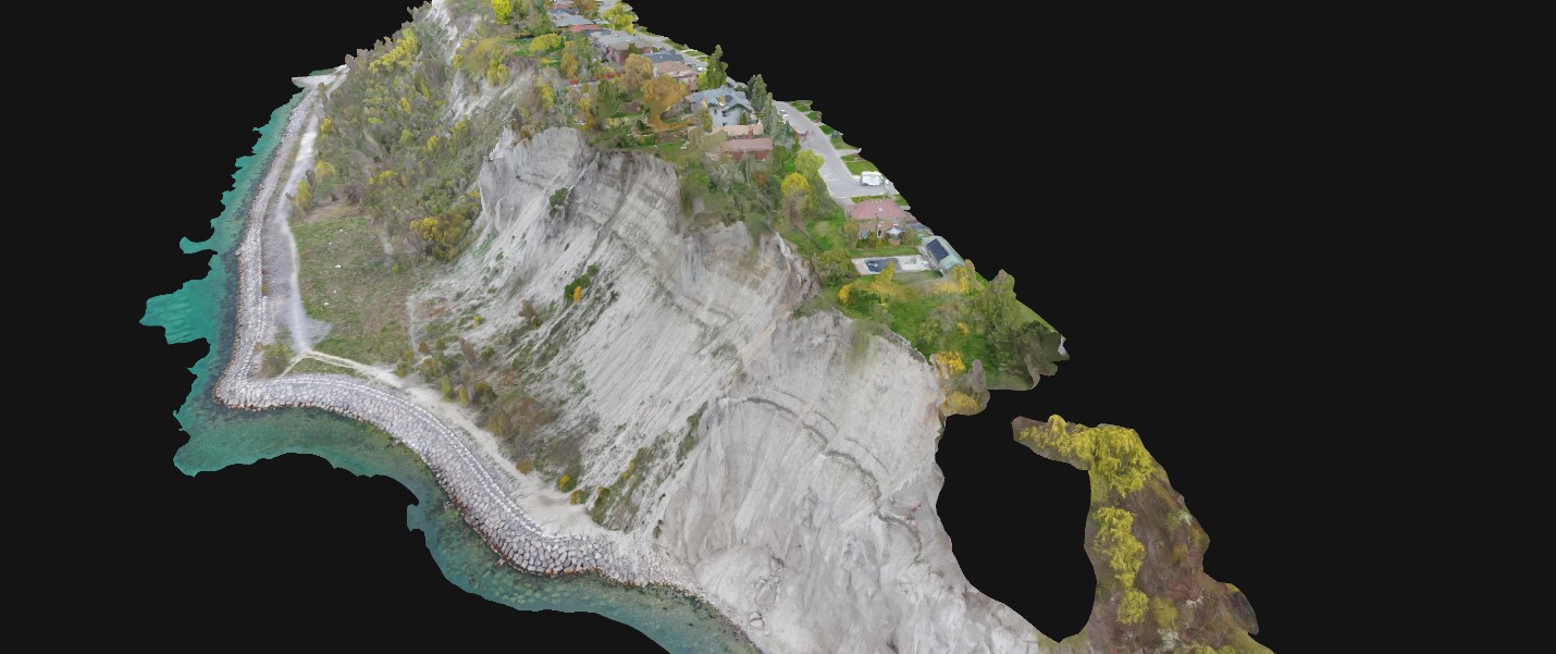
Screenshot of an interactive 3D photogrammetry model processed by the RPAS team from Bluff Recession data collection.
Clip of a video inspection for a shoreline erosion control structure at Colonel Sam Smith Park.
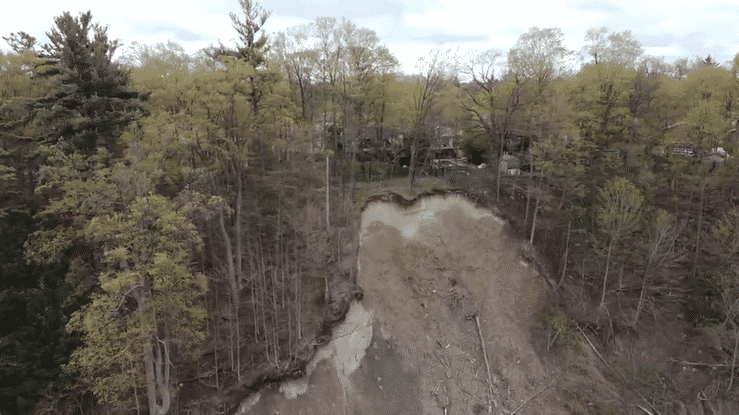 GIF of a video inspection of slope failure behind Botany Hill Road.
Sincere thanks the entire Erosion Risk Management team for all of their contributions!