Watershed Planning & Ecosystem Science – Summer 2020 Team Updates
September 22, 2020
GOOD NEWS STORIES
• Published Assessing terrestrial wildlife populations in the Toronto and Region Area of Concern by the Journal of Great Lakes Research. A shareable link will be available January 2021.
• Set up 3 new bat acoustic recorders at 3 sites to gain a greater regional understanding of bats. We also visited 8 conservation areas to conduct bat emergence surveys. Bat meter data analysis for 2 sites has been completed for this year.
• Circulated the Summer 2020 edition Monitoring Matters e-newsletter to 434 subscribers. This edition highlighted the draft Carruthers Creek Watershed Plan, current open data sets, new Toronto Remedial Action Plan beaches delisting criteria, and current reports and research.
• Finalized the Highland Creek Greening Strategy, which will be taken to TRCA’s Board of Directors for approval in September 2020.
• Completed the draft Carruthers Creek Watershed Plan – now available for public review. An in-person public open house will occur once Covid-19 restrictions have been lifted.
• Initiated the Etobicoke Creek Watershed Plan (ECWP); scoping is nearing completion, and characterization stage is well underway thanks to data and data analysis provided by all Watershed Planning and Ecosystem sub-units. New water quality and urban forest monitoring stations have been set up to support the ECWP.
• Completed 20+ fish rescues in support of Restoration and Infrastructure (R& I) projects.
AQUATIC MONITORING AND MANAGEMENT
• Sampled 70% of the Regional Watershed Monitoring Program (RWMP) benthos monitoring sites to date. Data on benthos are collected annually at over 100 RWMP stations across the Toronto region. View Social Media Post
• Surveyed 75% of the RWMP fish and habitat monitoring sites to date. 2020 marks the sixth year that monitoring is focused in the Don River, Mimico Creek, Highland Creek, Petticoat Creek and Frenchman’s Bay watersheds. View Social Media Post
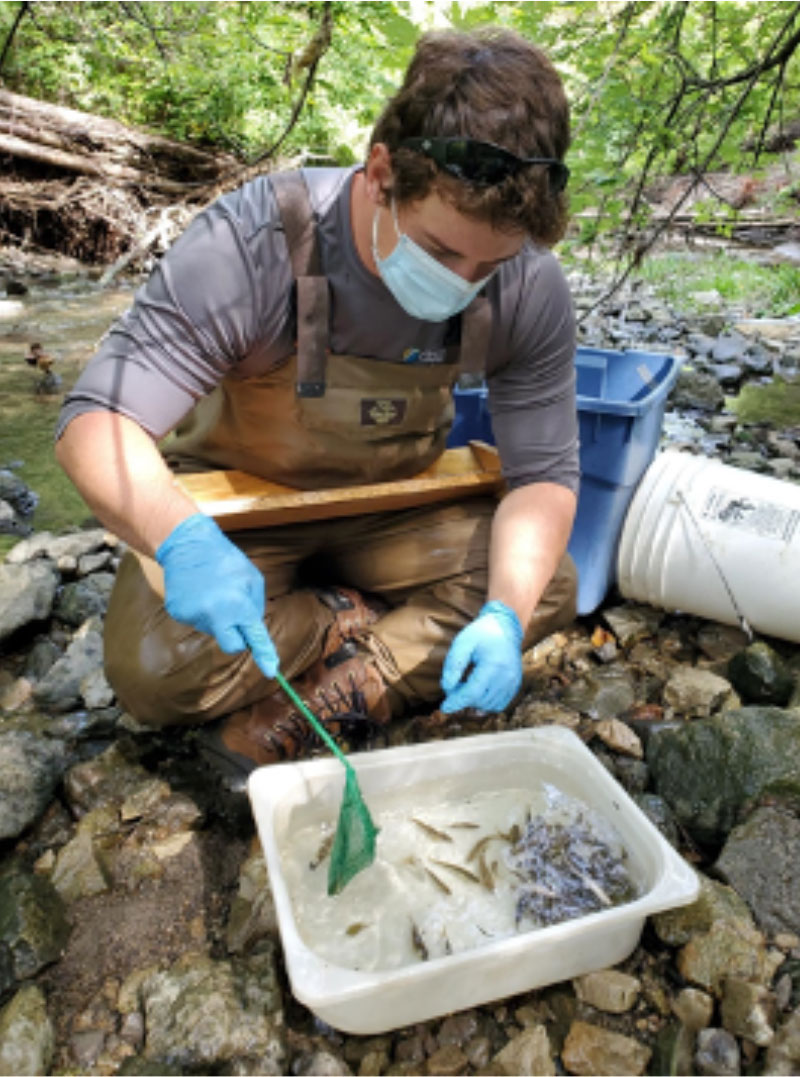
Jared Skeath, Field Assistant, helps to sort fish by species for the fish stream habitat and community assessments.
• Hired nine seasonal staff to assist with RWMP benthos and fish habitat and community assessments.
• Hired Don Little to coordinate Environmental Impact Summaries for bank stabilization and erosion projects (R & I). To date, 3 Baseline condition reports have been written + 7 are in draft.
• Conducted waterfront electrofishing surveys along 40 transects in support of the Ashbridge’s Bay Landform Project (Ashbridge’s), Scarborough Waterfront Project, Gibraltar Point Erosion Control Project, Tommy Thompson Park Master Plan and Don Mouth Naturalization and Port Lands Protection Project (Don). Aquatic vegetation surveys have also been completed for Ashbridge’s and Don projects. View Social Media Post
• Conducted additional waterfront fish community surveys for the Ashbridge’s Bay Landform Project and Scarborough Waterfront Project using seine nets. Minnow traps were set in Duffins Creek wetlands (Ashbridge’s Bay Landform Project) and along Cherry Street (Don Mouth Naturalization and Port Lands Protection Project). These initiatives gauge how native fish are utilizing new habitat offset areas.
• Continued to collect monthly RWMP water quality samples at close to 50 watershed sites unique to TRCA properties as well as some that have been adopted from Ontario’s Provincial Water Quality Monitoring Network. In addition to this work, 15 water quality monitoring stations have been set up this year to support the next update to the Etobicoke watershed plan.
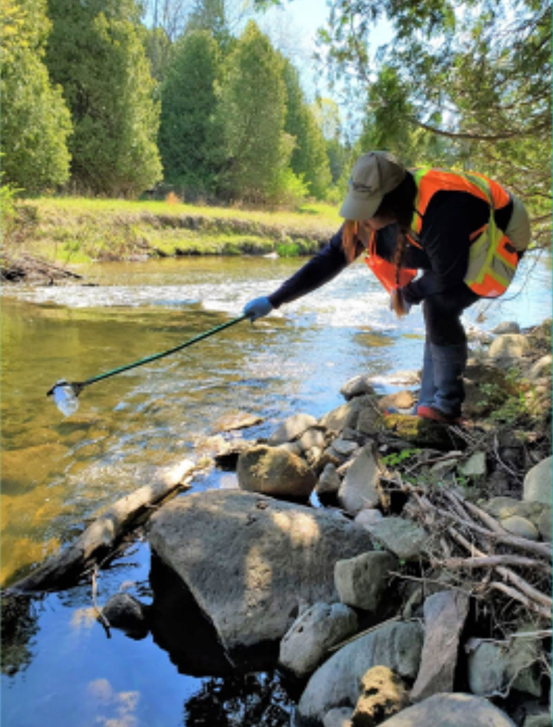
Sam Everson, Crew Leader, hard at work collecting monthly RWMP surface water quality samples.
• Installed water temperature and level loggers to support the RWMP and other R&I projects. Routine maintenance of the year-round equipment is done periodically.
• Evaluated the large-scale Seaton development lands monitoring program (initiated in 2014) in order to assess the data collected to date and to determine next steps.
• Monitored Provincial Groundwater Monitoring Network wells for water level data and sampled some of the wells for water quality.
• Collected night electrofishing surveys along 67 transects. View Social Media Post
• Caught 848 invasive Sea Lamprey in the Humber River trap and 115 in the Duffins Creek Trap. 2020 numbers are low in the Humber but it could be an anomaly related to weather, lake levels, or something to do with the attractiveness of the Humber vs. other nearby rivers.
• Collected water quality samples to support scientific monitoring of Lake Ontario’s water quality in the Pickering and Ajax nearshore.
• Downloaded fish movement data from acoustic receivers located across Toronto harbour. With our assistance, researchers from Carleton University and Fisheries and Oceans Canada have tagged over 500 native and non-native fish with acoustic transmitters since 2010. This study enables resource managers to learn how fish are using restored habitats in order to enhance or expand restoration efforts throughout the Toronto Harbour.
• Finalizing the update to the Toronto Waterfront Aquatic Habitat Restoration Strategy (TWAHRS). The Strategy provides guiding principles and practical tools for implementing habitat projects across the Toronto Waterfront. We will be presenting about TWAHRS at the October Toronto RAP Lake Ontario Evenings talk.
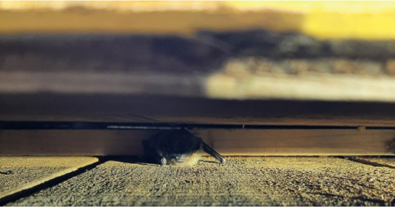 Native Bat Hiding Under Sign at Claremont Conservation Area
TERRESTRIAL INVENTORIES AND MONITORING
• Updated 2020 flora and fauna scores and ranks are available online. All flora and vertebrate fauna species, as well as vegetation communities, found in the Region have been assigned a rank based on scores that measure their local abundance as well as their sensitivity to development impacts.
• Finalized the 2015 Rouge National Urban Park Terrestrial Biological Inventory and Assessment Report with Parks Canada.
• Produced a Species Spotlight video on the Hooded Warbler.
• Completed monitoring for 23 regional frog monitoring sites (29 stations) and 2 project sites (5 stations). Data has been entered for 2020.
• Completed breeding bird monitoring and inventory for 21 regional bird monitoring sites (29 meadow, 24 wetland and 59 forest stations), as well as 3 project meadow bird sites (11 stations), 1 project wetland bird site (1 station) and 1 project forest bird sites (5 stations). 2020 data has been entered for two visits. View Social Media Post
• Completed second visit (2 total) to 22 RWMP long-term forest vegetation monitoring sites (1 plots) and to 2 project forest vegetation sites (8 plots). 25 RWMP wetland transects were also surveyed. Data has been entered for first forest visits.
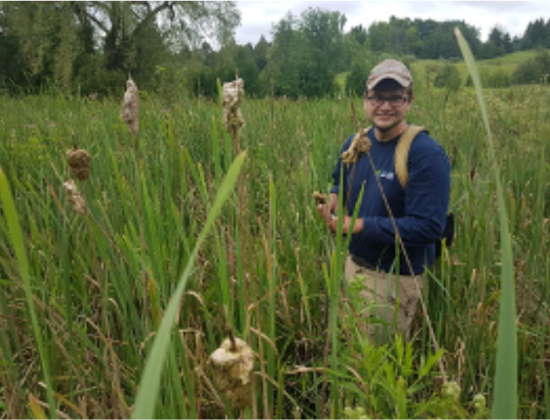
Alex Haney, Field Assistant, evaluates soil core samples at long-term RWMP wetland vegetation transects.
• Completed breeding bird monitoring and inventory for 21 regional bird monitoring sites (29 meadow, 24 wetland and 59 forest stations), as well as 3 project meadow bird sites (11 stations), 1 project wetland bird site (1 station) and 1 project forest bird sites (5 stations). 2020 data has been entered for two visits.
• Completed second visits to ~ 500 ha of inventory area (~6 sites) for vegetation mapping and flora species of conservation concern, and second visits for fauna inventory at 15 sites covering ~1200 ha. Fauna inventory data (~2000 species points entered) has been entered.
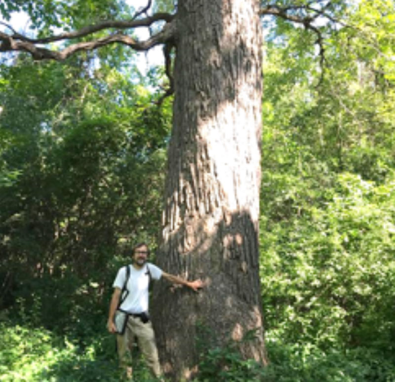
Gavin Miller, Flora Biologist, standing beside old-growth Burr Oak at Humber Arboretum.
• Completed third butterfly monitoring visit (4 total) at 2 meadow project sites (9 transects). View Social Media Post
WATERSHED PLANNING AND REPORTING
• Continued to fill data gaps in the Humber watershed in anticipation of starting the update to the watershed plan.
• Continued to develop the Watersheds and Ecosystems Reporting Web Application. The launch has been set for April 22, 2021 (Earth Day). This will be the next iteration of The Living City Report Card.
• Assisted our municipal partners with their Municipal Comprehensive Reviews as they work to update their Official Plans.
• Continued to work on MITACS proposals; one looks at the historical creeks of Toronto in partnership with the City of Toronto and Ryerson University (MITACS approved), and a second one looks at erosion sensitivity in the Etobicoke Creek watershed as part of the watershed plan, in partnership with the University of Waterloo (proposal stage).
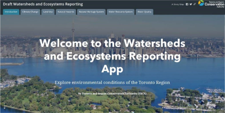
Splash page of the Watersheds and Ecosystems Reporting Web Application platform – launch Earth Day 2020.
ECOSYSTEM AND CLIMATE SCIENCE
• Initiated a divisional strategic implementation planning exercise for both Development and Engineering Services and Policy Planning. For a copy of the Project Charter please contact Noah Gaetz.
• Provided a webinar series focused on green infrastructure (GI) asset management planning, in partnership with the Green Infrastructure Ontario Coalition (GIO).
• Completed technical analysis to measure potential ecological impacts of two proposed infrastructure projects (GTA West and Ontario Line) using TRCA biological inventory and monitoring data, habitat connectivity data, and natural cover data. This information was used by the Infrastructure Planning and Permits (IPP) team to prepare a board report outlining the potential impacts of proposed alignments and associated TRCA recommendations.
• Completed data gap analysis for ecological needed to address the ECWP objectives. components of Etobicoke Creek Watershed Plan (ECWP). This included terrestrial, aquatic, water quality, water quantity, and policy components such as Natural Heritage System and WRS data. Improved understanding of the gaps helped identify key actions
• Published the Wetland Hydroperiod Guidance Document (TRCA, CVC, and Conservation Halton data over 2012-2019). The document defines a range of normal/reference conditions for four wetland community types (marsh, swamp, thicket swamp, and shallow aquatic). This information will help to assess the likely impacts of land development and related activities (dewatering, effluent discharge, etc.) on adjacent wetlands, as well as providing target conditions for restoring different wetland communities.
• Conducted a virtual workshop on invasive species prioritization framework to engage and gather input from partner municipalities, CAs, and non-profit organizations (in partnership with University of Toronto and funded by Mitacs Inc.).
• Conducted research on tree water balance and begun crafting a theory on how to model tree-stormwater interactions using existing SWMM5 features.
• Completed an analysis review of the 2018-2019 road ecology data and prepared a draft technical report.
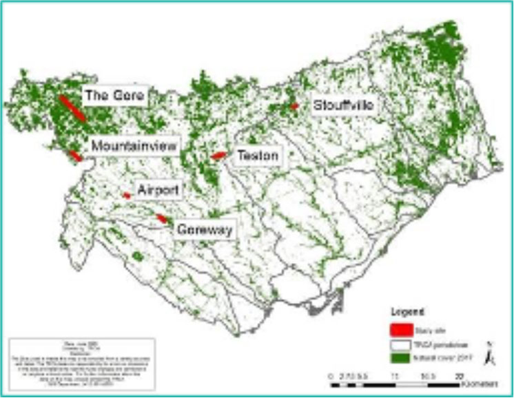
Locations of 7 road ecology study sites surveyed in 2018 and 2019 in Peel and York Region within the TRCA jurisdiction.
• Hosted a workshop for York Region on developing an updated forest valuation method for their Green Infrastructure Asset Management Plan.
• Produced bias corrected climate change data for Durham Region, Grand River Conservation Authority, and TRCA’s Etobicoke Creek watershed. Provided guidance on incorporating the data into impact models.
• Contributed to Urban Trees and Human Health: A Scoping Review paper (June 2020) that provides a comprehensive summary of existing literature on the health impacts of urban trees that can inform future research, policy & nature-based public health interventions.
• Prepared the Thornhill climate change resilience strategy for the draft Thornhill Sustainable Neighbourhood Action Program.
• Hosted webinars for Federation of Canadian Municipalities’ Community of Practice program on Reducing Emissions in Buildings for a Green Recovery.